Contact us
Reach out to us and a representative from one of our 26 worldwide office locations will contact you shortly.
Please login to your designated client portal:
undefined - March 15, 2021

When the Northern Hemisphere transitions into winter, the Arctic cools rapidly—creating a sharp temperature difference with the Tropics, which maintain their warmth year-round. This temperature gradient creates intense winter storms that barrel across the Pacific at high speeds, generating swells that can travel thousands of miles.
Off the west coast of Japan and across the Pacific, cargo ships are facing darkness, heavy weather, and freezing spray this winter. Ship captains traversing these vast, remote areas of the world rely on expert routing advice to safely deliver their cargo.
In late 2020, a Panamax Bulker owned by Taiwanese owner Sincere Navigation was carrying soybeans from the Pacific Northwest toward China. With an active storm track forecast in the mid-latitudes, southern routes were not ideal. Taking consideration of the slow speed of the Bulker and thus its limited ability to divert around rapidly developing storms, StormGeo Route Analysts recommended a northern route, which the vessel accepted. Just a couple days later, weather models confirmed a series of strong storms tracking across the central Pacific, bringing heavy swells south of the Aleutian Islands that obstructed all southern routes. The Panamax Bulker successfully avoided these heavy seas and arrived in China with all crew and cargo safely by their Required Time of Arrival. If the Bulker had sailed the originally intended route south of Japan, the journey would have taken an additional 12 days as well as exposure 9-10-meter swells directly on the vessel’s bow.
Mr. W.P. Luan
Vice President, Sincere Navigation Corporation
Armed with the most up-to-date and accurate weather forecasts, our Route Analysts study present weather patterns while comparing them to similar patterns over past years. This access to and understanding of precise data enables them to provide the best route option for every vessel under their care. While all routes are considered for sea passages, routes that sail north across the Gulf of Alaska and into the Bering Sea are preferred for westerly crossings. This is due to the counterclockwise rotation of storms in the Northern Hemisphere, as well as the easterly progression of storms. Because these combined forces create strong westerly winds and swells to the south of a storm’s center, passing to the north allows vessels to avoid these regions of heavy weather.
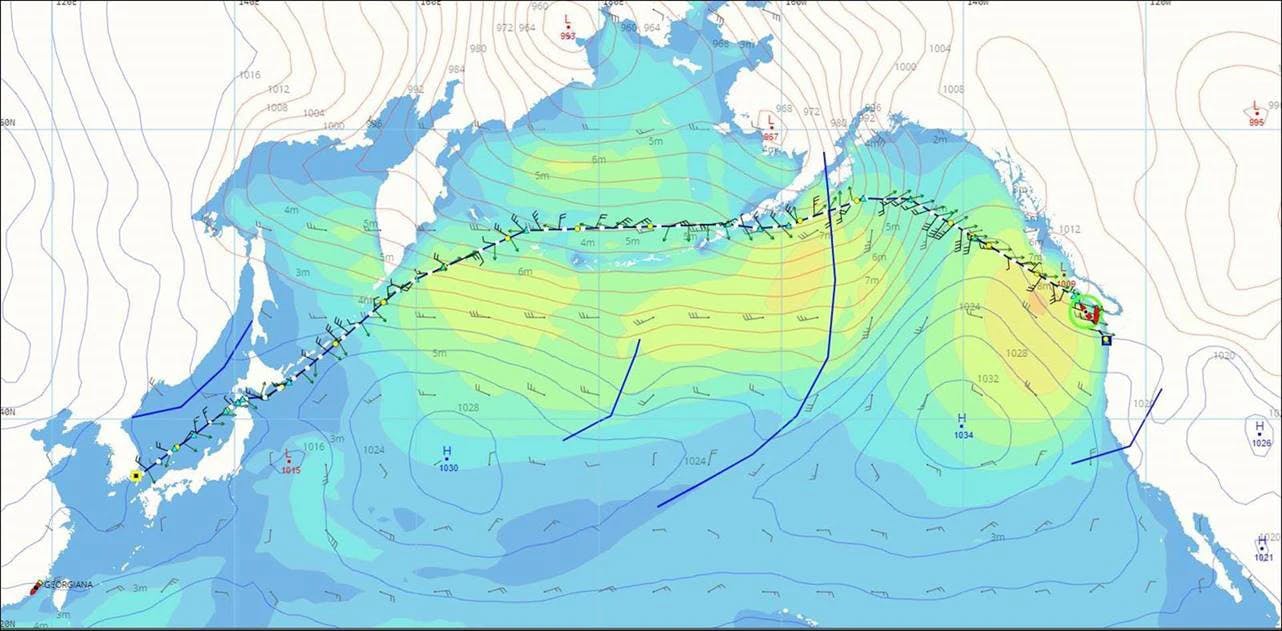
In the image above, the route recommended by StormGeo Route Analysts for the Panamax Bulker is shown. The vessel takes the recommendation—sailing above the heaviest seas and arriving in China with all crew and cargo safe.
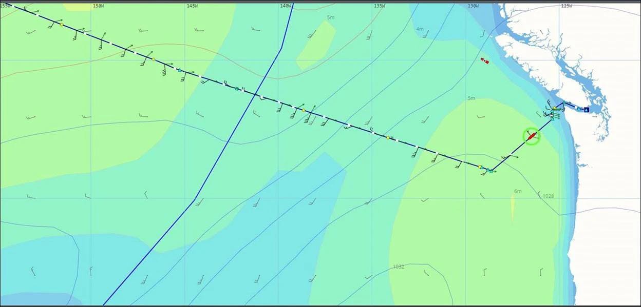
In the below image, we see a vessel from the same period with an initial southern route. This vessel met heavy conditions early on and was forced to change course to the north and accept the resulting delays.
Guiding vessels around winter storms requires diligence and expertise from StormGeo Route Analysts, who must also work together to support both the vessels at sea and their clients in offices. With spring on the horizon, they will continue to work tirelessly to provide much-needed support to their clientele across the world.

News
April 25, 2024
This change underlies the ongoing commitment to provide comprehensive and integrated solutions.

News
March 18, 2024
With complete ownership, both companies can continue integrating their human expertise and technological innovations to better serve regional clients.
Article
March 16, 2024
Early Outlook for the 2024 Hurricane Season

Case
March 7, 2024