Contact us
Reach out to us and a representative from one of our 26 worldwide office locations will contact you shortly.
Please login to your designated client portal:
Article - May 3, 2022

Data from around the world are fed into computer models, which use complex equations with many variables to predict weather patterns. Just as these models can predict the development of storm systems that bring rain or snow in the winter months, these same models can predict the development of low pressure areas in the tropics that can develop into hurricanes. However, accurately predicting the precise track of a hurricane days in advance remains a problem. The difficulty lies in obtaining accurate atmospheric data across the tropical oceans. Without direct observations, we must estimate what is happening at all levels of the atmosphere across the oceans. As with any computer program, bad or insufficient data will result in a poor forecast. This is why aircraft reconnaissance is so important: the more accurately we can define the initial conditions in the tropics, the better we can predict the path and intensity of a tropical cyclone.
Modern computer models can predict day-to-day weather as far as two weeks out. Often, they can pick up on potential tropical cyclone development 7-10 days in advance. This gives us the ability to initiate advisories on tropical disturbances days before they are classified as tropical depressions or tropical storms. In 2016, StormGeo initiated advisories on a disturbance in the eastern Atlantic nine days before it developed into Hurricane Hermine. This provided businesses in the eastern Caribbean Sea and the Gulf of Mexico time to prepare for the storm.
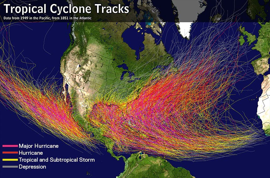
The Gulf of Mexico is a body of very warm water that lies in the tropics, making it an ideal environment for hurricanes.
There is no conclusive evidence that global warming is having any effect on hurricanes. Looking back over the past 100 years, there has been a definite increase in the number of hurricanes, however, this is likely due to better detection techniques. Prior to observing the Tropics with earth-orbiting satellites (the first weather satellite was launched in 1959) the knowledge of the existence of hurricanes and other tropical systems relied mainly upon the human eyes of those aboard ocean-going ships.
We now know with certainty that for the past 40 years, worldwide tropical cyclone activity has actually been declining. As for intensity, there are more strong hurricanes now than in the past. Again, this may be contributed to poor observations in the past. Without reconnaissance and satellite data, many strong hurricanes were likely missed prior to the mid 1900s. One thing we do know is that hurricane impacts along the U.S. coast have actually shown a slight decrease over the past 100 years.
A subtropical storm is a low pressure area that forms in the tropics or subtropics. The tropics are a region identified as the area north of the Equator to the Tropic of Cancer and south of the Equator to the Tropic of Capricorn. The subtropical regions are defined as areas extending approximately 12 degrees of latitude north and south of the tropics. Unlike a tropical storm, a subtropical storm typically does not have its strongest winds or heaviest squalls over the center. This makes it more difficult for the storm to strengthen.
A slower-moving hurricane increases the amount of time that its strong winds impact a location. In addition, the amount of rainfall that a hurricane produces is directly related to its speed of movement. For example, a hurricane moving at 10 mph may produce 10 inches of rain. This is true for any tropical low pressure area, not just hurricanes. Any tropical low can produce extremely heavy rainfall if it moves slowly across an area.
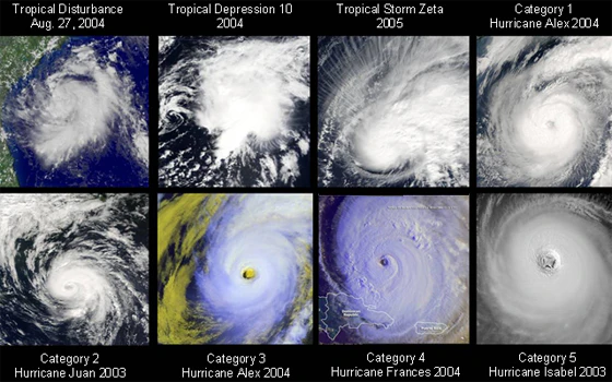
Tropical Disturbance: An area of squalls which may be associated with westward-moving low pressure areas that move off the west coast of Africa in the summer months, or they may be associated with weak frontal boundaries that extend into the tropics or subtropics. There is no circulation center at the surface.
Tropical Depression: A low pressure area over the tropical ocean that has a well-defined low-level circulation center along with organized squalls around the center. Winds are less than 39 mph.
Tropical Storm: A low pressure area over the tropical ocean that has a well-defined low-level circulation center along with organized squalls around the center. Winds are 39-73 mph.
Hurricane: A low pressure area over the tropical ocean that has a well-defined low-level circulation center along with organized squalls around the center. Winds are 74 mph or greater.
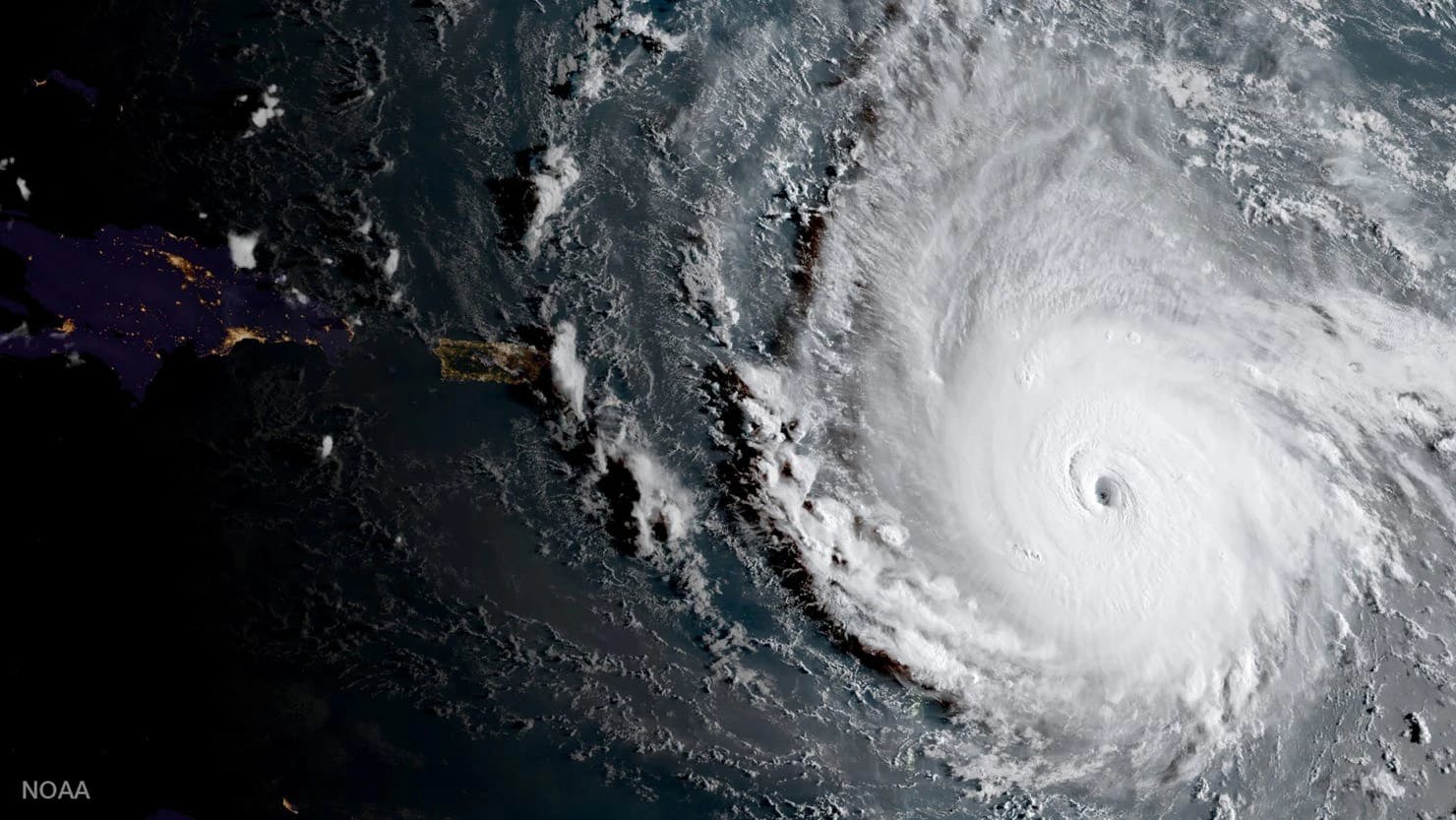
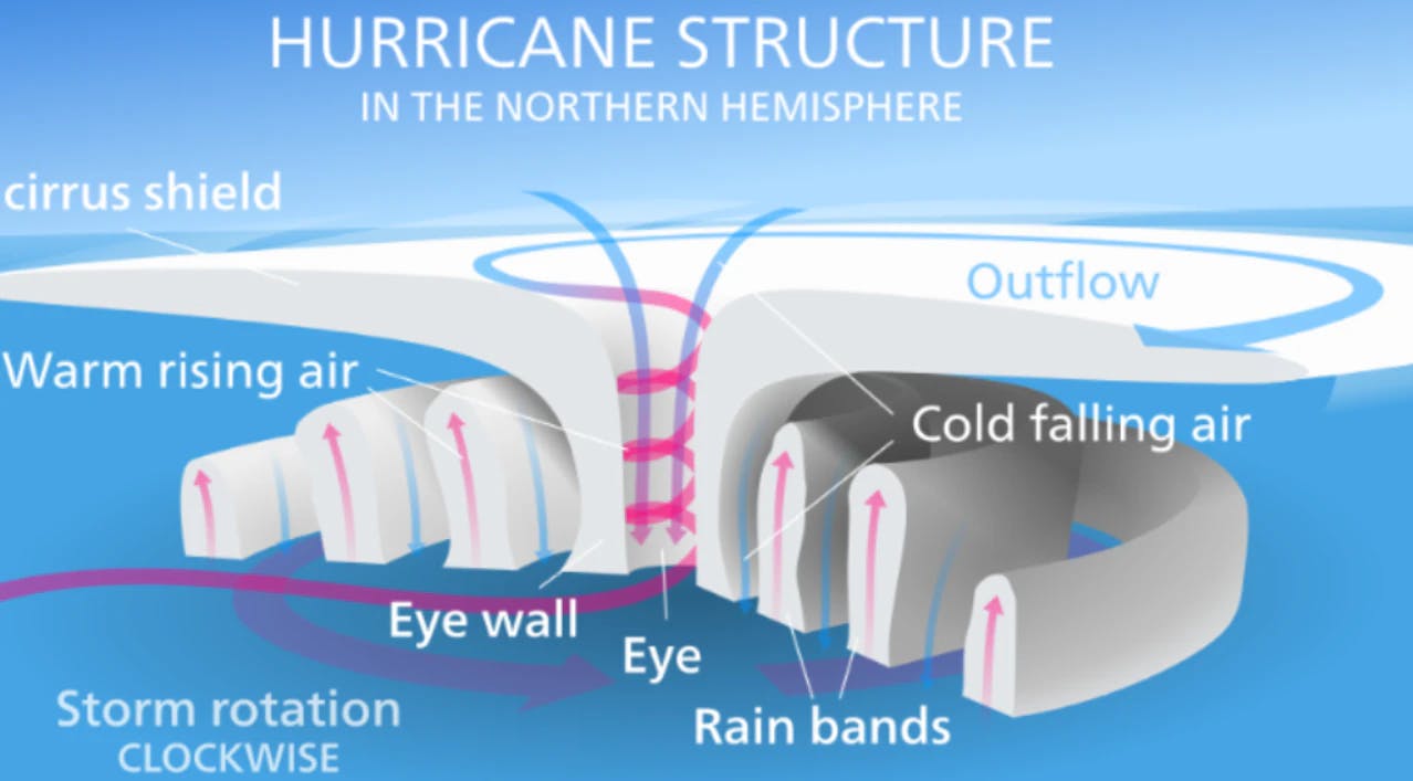
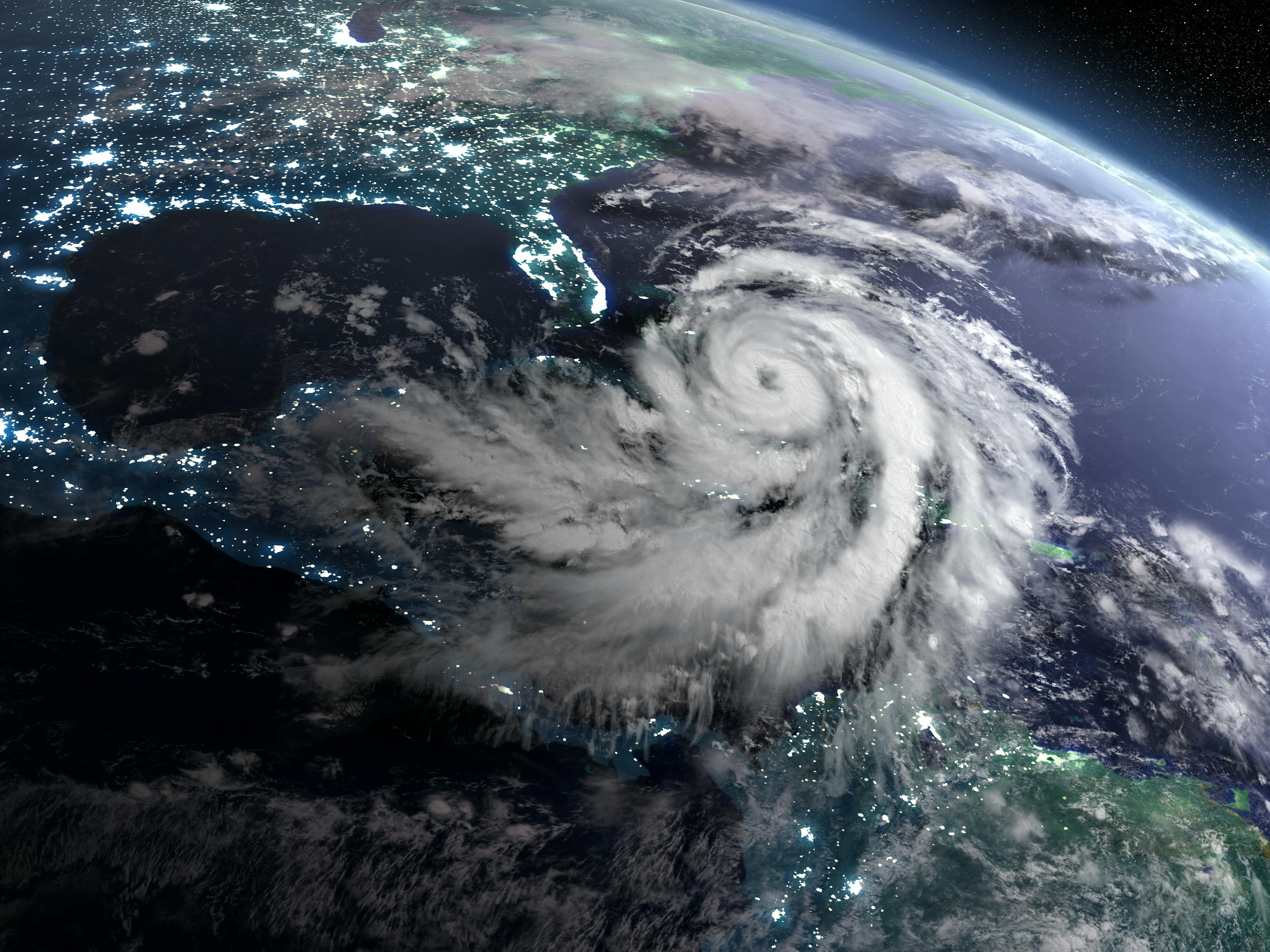
The eye is a feature which is unique to strong tropical cyclones like hurricanes (or typhoons). Warm, moist air spiraling into the center of a hurricane reaches a point where it no longer tracks into the center. Instead, it rises up into the atmosphere as high as 10 miles, forming the eyewall. The eyewall is a circular ring of intense squalls surrounding the center of a hurricane and contains a hurricane’s strongest winds. This ring of intense squalls can be as small as one mile or as large as 100 miles in diameter. Inside the eye, close to the center, the winds are relatively calm, often less than 25 mph.
A particularly dangerous “myth” is the misconception that a hurricane’s storm surge is a direct function of its Saffir-Simpson category (i.e. a Category 3 storm). Many hurricane response plans are based on a hurricane’s Saffir-Simpson ranking. For example, a coastal business may have a plan that only requires evacuation for a Category 3 hurricane or greater. There are a number of variables that contribute to storm surge, and its Saffir-Simpson ranking is only a slight factor. Much more significant is the size of the hurricane’s wind field—a large Category 2 hurricane will produce a greater storm surge than a small Category 4 or 5 hurricane. Every hurricane is different, so never rely solely on a hurricane’s Saffir-Simpson ranking to estimate storm surge.
News
March 18, 2024
With complete ownership, both companies can continue integrating their human expertise and technological innovations to better serve regional clients.
Article
March 16, 2024
Early Outlook for the 2024 Hurricane Season

Article
March 1, 2024

Case
December 14, 2023